With the app update 2.16.7, we have made a few changes to our map styles.
Update 2025: Although the “Google Maps” style can still be selected, only “OpenStreetMap” is now displayed in the app.
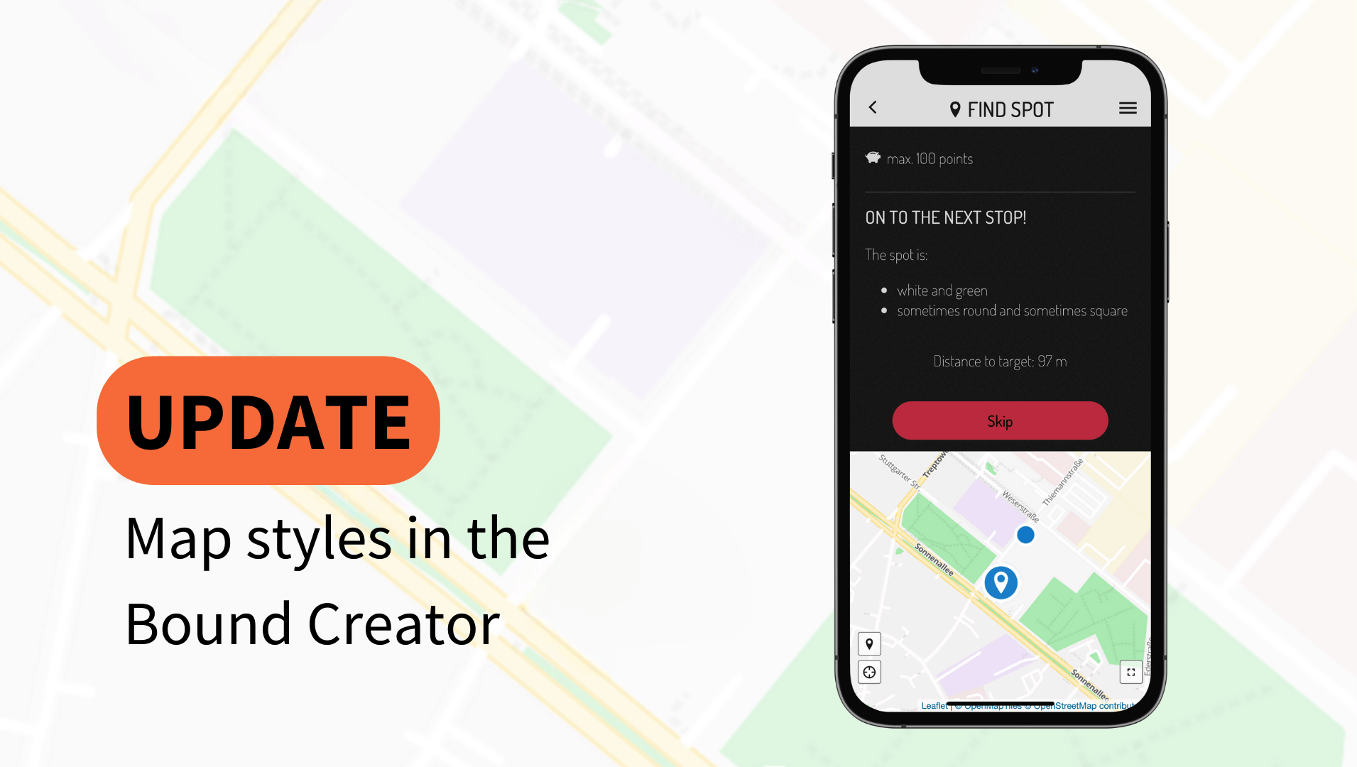
Various map styles are available to you in the Bound settings. The style you have selected will be displayed to the players in your Bound in Find spot elements and on the map in the menu in the app.
Note: Only one style per Bound can be selected.
Important: All styles from Stamen (Terrain, Toner and Watercolour) will be replaced by alternatives from OpenStreetMap.
Note: The style "Google Melanzani" is no longer selectable for your Bounds.
You had set this style for your Bound? Don't worry, it will still be displayed to your players.
As a general rule, players with older versions of the Actionbound app will be shown OpenStreetMap Bright if maps are not available.
The preview in the Bound Creator also only ever shows OpenStreetMap Bright.
Tip: Would you like to view the selected map style in the app?
Click "Test in the app" above the element in the Bound Creator to view an element in test mode in the app!
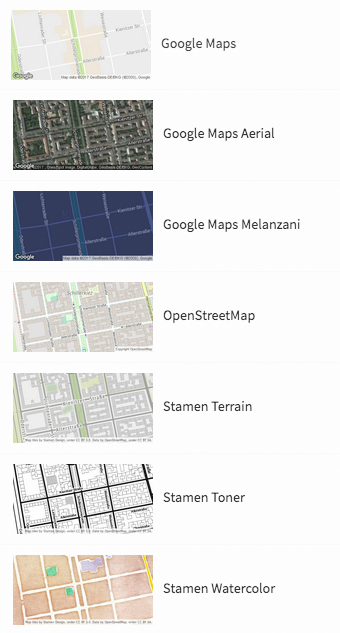
The following styles are available until further notice:
- OpenStreetMap Basic (new)
- OpenStreetMap Bright
- OpenStreetMap Liberty (new)
- OpenStreetMap Positron (new)
- OpenStreetMap Toner (replacement)
- OpenStreetMap Darkmatter (new)
- OpenStreetMap Qaunt (new)
- OpenStreetMap Klokantech 3D (new)
- OpenStreetMap Fiord Colour (new)
- OpenStreetMap High Contrast Pattern (new)
Want to know how to choose from the different styles? Then take a look at our manual in the article on
map styles. There you will also learn how to create a track visible on maps for your players.
Have fun trying it out!
In the last few weeks we've put a lot of effort into the map-based features of Actionbound. We're happy to present the results to you.
Note: Stamen styles will no longer be supported from February 2024. Find more information about our map styles
here.
Actionbound now also supports OpenStreetMap! But that's not all. We have also implemented the beautiful maps of Stamen Design and some new styles for Google Maps.
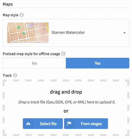
The maps from OpenStreetMap and Stamen Design can even be preloaded for offline usage. Players can now use the maps while playing a Bound to easier find the way and solve the GPS based task "Find spot" even if they don't have an internet connection.
The maps are set in the Bound's settings and will be displayed in the Bound Creator and the Actionbound app where ever maps are shown.
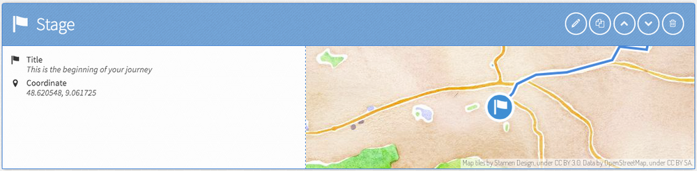
The track the players have to go to complete the Bound can now be displayed as a blue line on all maps. The route is defined by a track file (GeoJSON, GPX or KML) which helps the players to stay on the right way. Track files can be recorded with a GPS device or be created with a browser based tool, e. g. GPSies, OpenRouteService or Google Maps. This file can be uploaded in the section "Track" in the settings of a Bound.
Furthermore there is the possibility to create the track automatically based on the stages. It is important that GPS coordinates are set for the stages. With one click these stages are connected with a straight line and a track is created.
The start point will now be shown on more maps and a coordinate for the destination can be set.
Now it's your turn: Start to create your DIY digital scavenger hunt or interactive amazing race with Actionbound right now!
Also new with Actionbound 2.9
- The look and feel of the Actionbound app is now more lightweight
- Zoom into pictures
- Support of Turkish and Arabic language
- Improvement of the list sorting feature
… and much more! Check out our download page to get the latest version of the Actionbound app.
